AtmosphericX - Placefiles (GUIDE)
Accessing Placefiles and Configuring Your Program
Placefiles are links that are available to be copied and used on many weather-related programs such as GR2Analyst and SupercellWX. The AtmosphericXteam utilizes several different placefiles during chases and at-home operations when monitoring weather. Listed below are several placefiles made by the AtmosphericX which can be self hosted or used directly from the AtmosphericX public instance.
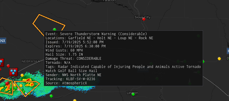
Alerts Placefile
Displays polygons and points for active alerts using the AtmosphericX alert framework. This placefile is optimized for radar programs like Gibson Ridge (GRLevelX) and SupercellWX, which support the native placefile format.
Example:
http://<address>:<port>/placefiles/alerts
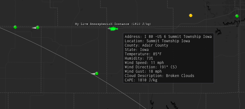
GPS Placefile
Integrates your RealtimeIRL or Spotter Network GPS location into your radar program. It shows your current position on the map along with additional details such as weather conditions, temperature, city, and more.
Example:
http://<address>:<port>/placefiles/gps
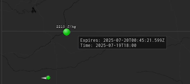
CAPE Placefile
Visualizes the latest CAPE (Convective Available Potential Energy) values on your radar program based on Nexrad radar site coordinates.
Note that this placefile uses GFS data, which may be less precise compared to HRRR CAPE values.
Example:
http://<address>:<port>/placefiles/cape