Project AtmosphericX (Features)
Below is a list of supported features for AtmosphericX. Please note that this is not a full list, as the project offers a vast array of functionalities beyond what is mentioned here. If you wish to improve this, feel free to submit a PR Request
NOAA Weather Wire Service (XMPP)
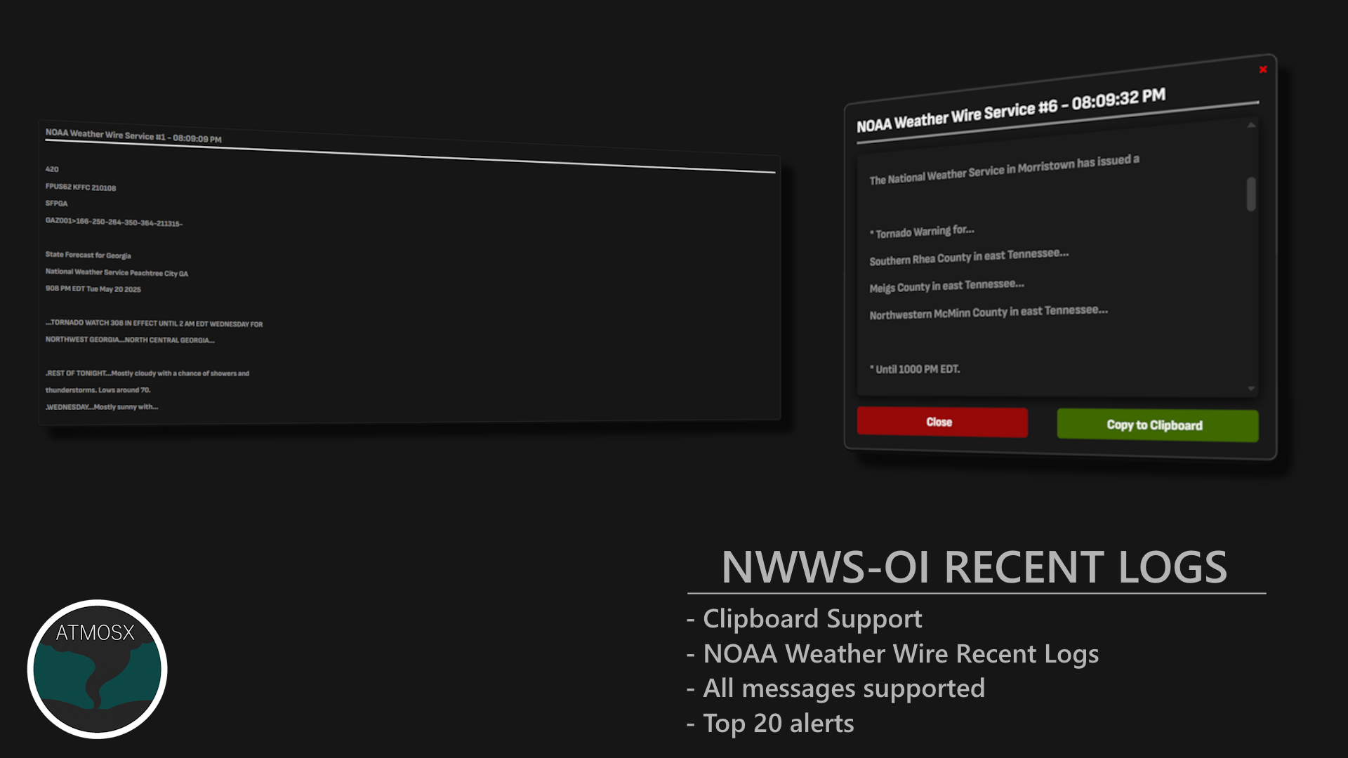
NWWS utilizes the XMPP (Extensible Messaging and Presence Protocol) for the immediate transmission of weather products as they are issued. With minimal delivery delay, NWWS is one of the fastest systems available for realtime event data. Messages are primarily distributed in plain text format. However, some alerts may also be sent in XML format using the Common Alerting Protocol (CAP). CAP is an open standard for exchanging emergency alerts and public warnings between alerting technologies. It provides a structured, XML format that enables easier integration, automation, and interoperability across different projects. In practice, the XML (CAP) version of an alert typically arrives 10 to 30 seconds after the plain text message, offering enhanced metadata and compatibility for advanced applications. However, with AtmosphericX, this is not in use by default as most information can be parsed from the plain text message.
Delivery Methods
Satellite (SBN/NOAAPORT Channel 201) This is a hardware based system that operates without the need for authentication, making it a highly reliable choice for broadcasters and emergency alerting services. Since it runs independently of internet connectivity, it remains functional even in network outages or disasters where online access is disrupted. Currently, AtmosphericX does not support this option, as it requires a dedicated hardware setup. However, future implementations may make this feature available, providing a robust and offline alternative for receiving alerts without relying on internet access.
Internet (NWWS Open Interface, or NWWS-OI)
AtmosphericX uses the internet method to receive alerts. While this typically requires a separate software setup, AtmosphericX simplifies the process with a built in XMPP client package. If you want to use this method, you’ll need to request access from the NWS. See Request access to NWWS-OI for more information.
Supported Alerts
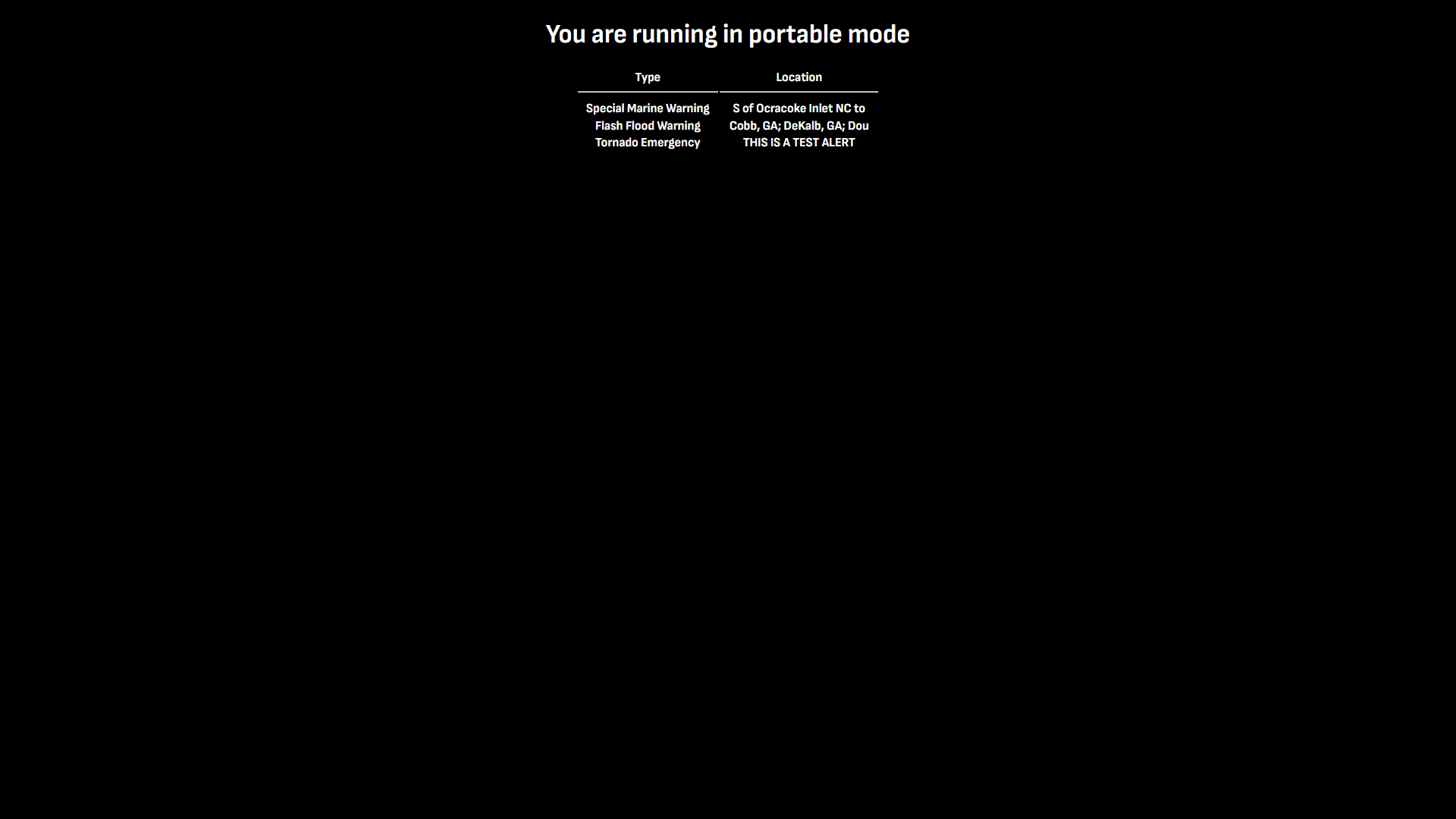
Natively, most alerts are supported. However, if an alert doesn’t contain a VTEC header it will be IGNORED. This is due to the limited tracking capabilities of the alert. If you wish to have more supported alerts, try enabling the XML feature located under the configurations. (sources.primary_sources.noaa_weather_wire_service.xml_alerts = true). Just beware that enabling XML may have a small delay for the alert to be recieved.
National Weather Service (NWS) API
The National Weather Service (NWS) API is a RESTful web service that provides structured access to official weather data through standard HTTP requests. It serves as a flexible and developer friendly alternative to NWWS, supporting a wide range of users, including developers, researchers, storm chasers, emergency managers, and the general public. Weather data is organized into GeoJSON, making it easy to parse, integrate, and analyze for applications requiring realtime updates and forecasting.
Delivery Method
The NWS API is accessible via RESTful web services and does not require special hardware or authentication.
- Internet (REST API)
Weather data is retrieved using standard HTTP GET requests. View the NWS API documentation. This method is ideal for applications requiring flexible, on demand access to weather data without maintaining a persistent connection or using specialized protocols.
NOAA Weather Wire Service vs NWS API (Brief Comparison)
| Feature | NOAA Weather Wire Service (NWWS) | NWS API |
|---|---|---|
| Delivery Method | XMPP (realtime) | RESTful API (HTTP requests) |
| Data Format | XML (CAP) or Plaintext | JSON (GEOJson) |
| Authentication | Required for Internet (NWWS-OI) | No authentication required |
| Speed | Fast, realtime delivery | Variable, depending on request frequency |
| Reliability | High, especially with hardware (SBN) | Dependent on internet connection |
| Accessibility | Broad, for institutional and individual users | Open access for developers and researchers |
| Supported Alerts | Limited to VTEC Requirements (Tracking) | Wide range of alerts and data |
| Use Cases | Emergency alerting, broadcasting | Custom applications, research, data analysis |
| Historical Data | Limited | Available through API endpoints |
| Error Proofing | Somewhat (Parsing Errors Can Happen) | More robust error handling |
Note: The NWS API is a great option for developers and researchers who want to build custom applications or analyze weather data. It provides a wide range of data and is easy to integrate into various systems. However, if you need realtime alerts and high reliability, especially for emergency situations, NWWS may be the better choice. Request access here.
Miscellaneous Sources and Features
Location Services
AtmosphericX integrates multiple location service tools to enhance accuracy and functionality. These tools help users track their location (latitude and longitude):
- Spotter Network
- RealtimeIRL
These services are integrated within the project to provide realtime and accurate location information based off longitude and latitude coordinates. This is especially useful for storm chasers and emergency responders who need to track severe weather events in real time within a specific radius of their location.
Tip: If you wish to modify the radius in miles, you can do so in the configuration file located at
sources.miscellaneous_sources.location_services.max_miles = x
Neither of these options are required for AtmosphericX to function, but they do offer valuable extra features that can improve the overall experience. Users can take advantage of these capabilities to expand functionality based on their specific needs, whether for better data access, customization, or enhanced situational awareness.
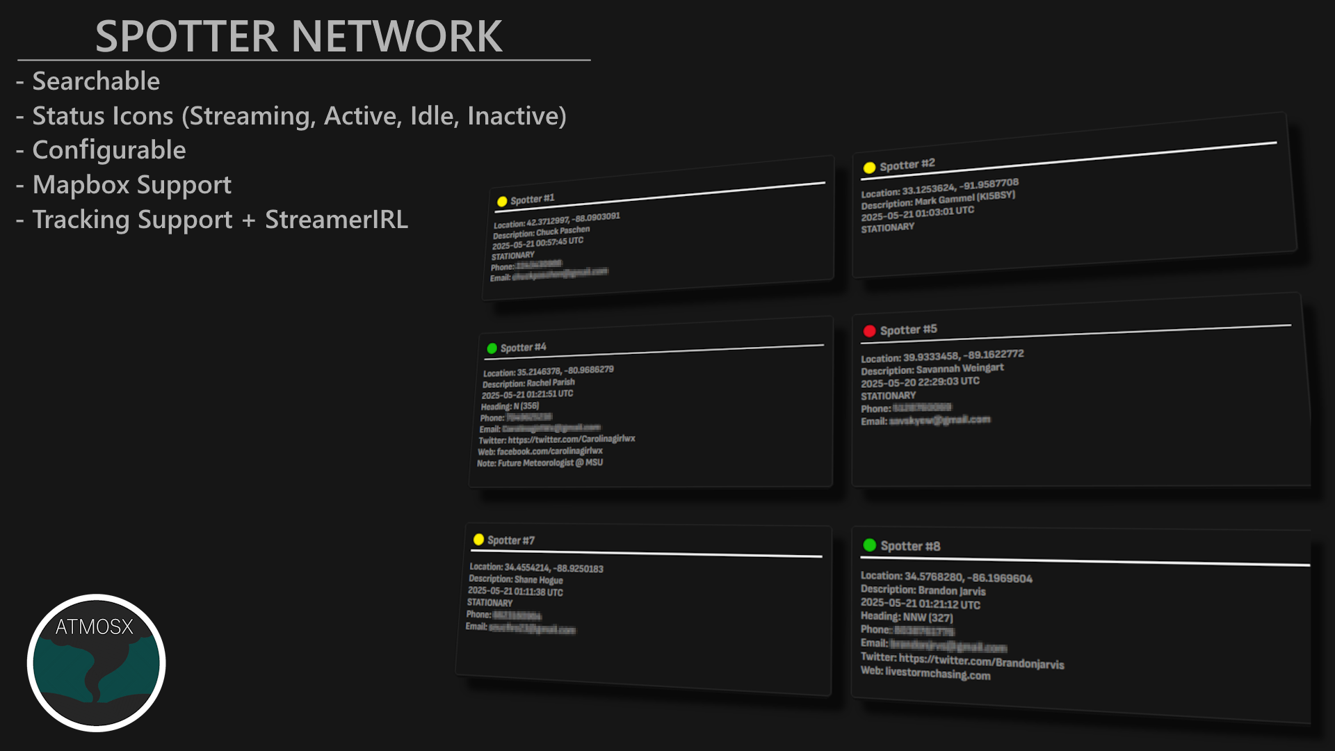
Spotter Network
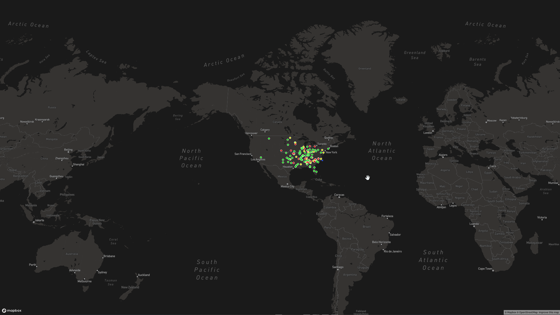
Spotter Network is a community of weather enthusiasts and storm chasers who share realtime weather data and reports. It provides a platform for users to report severe weather events, including tornadoes, hail, and severe thunderstorms. The Spotter Network integration in AtmosphericX allows users to access and visualize these reports on the dashboard, enhancing situational awareness during severe weather events. This also gives an option to filter out reports based on the distance from a chasers location ensuring that only relevant reports are displayed. Additionally, spotters will show up on the mapbox and dashboard, providing a visual representation.
RealtimeIRL (Pull key required)
RealtimeIRL is a location service that provides accurate and up to date location information based on latitude and longitude coordinates. It is integrated into AtmosphericX to enhance the accuracy of location tracking for users, especially storm chasers and emergency responders. By utilizing RealtimeIRL, users can ensure that their location data is precise and reliable, allowing for better decision making during severe weather events.
Location Name
Converts longitude and latitude coordinates into a human readable location name. This feature is useful for users who want to quickly identify their location without having to manually look up coordinates. It can be used in conjunction with the other location services to provide a comprehensive view of the user’s location.
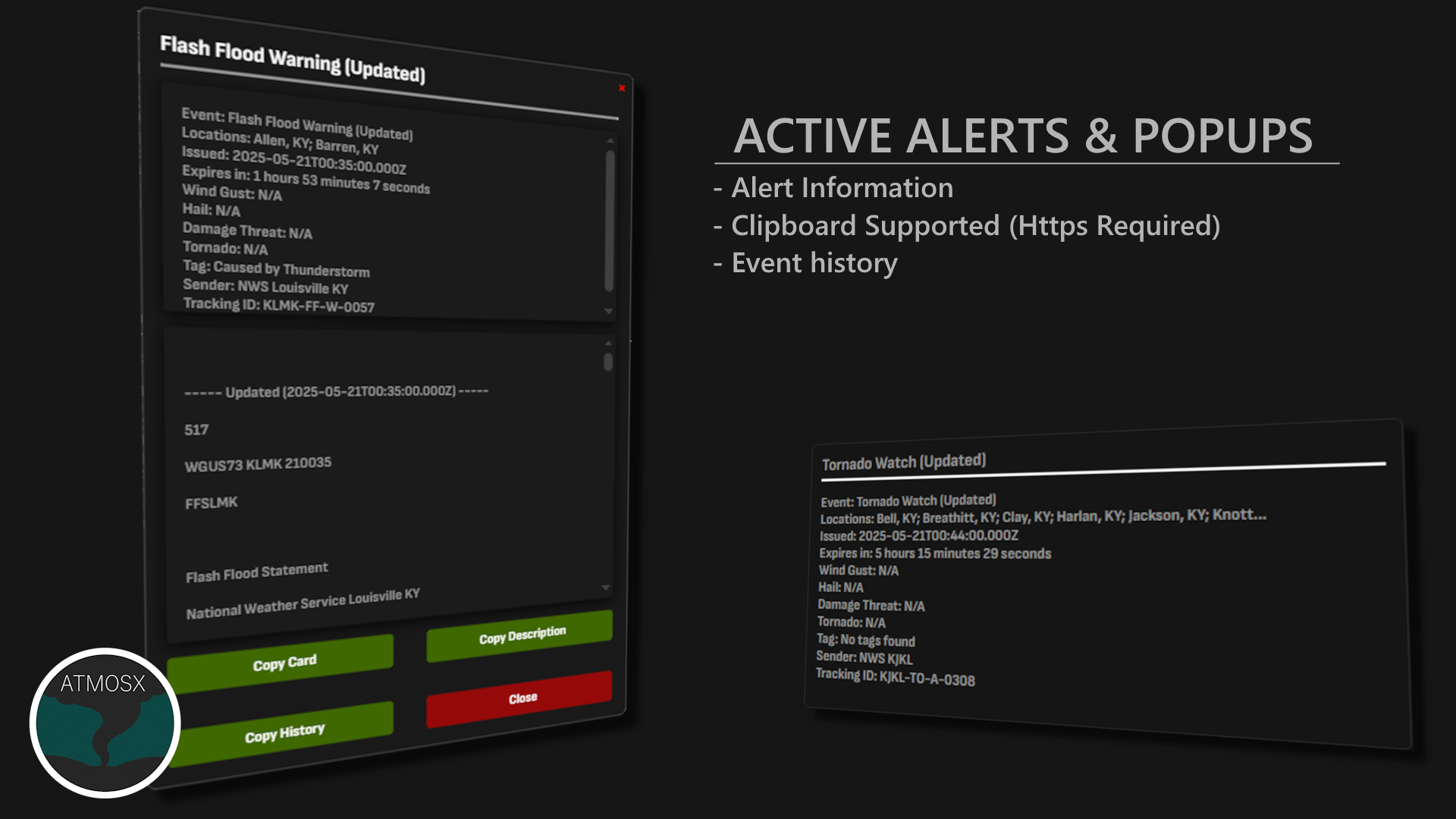
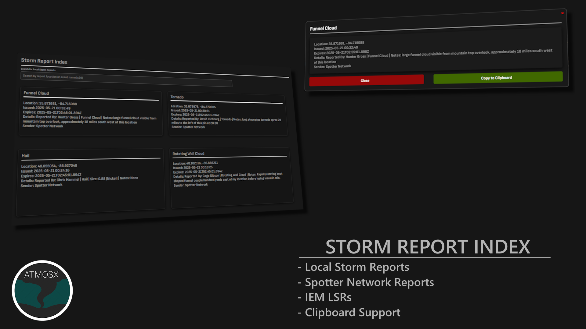
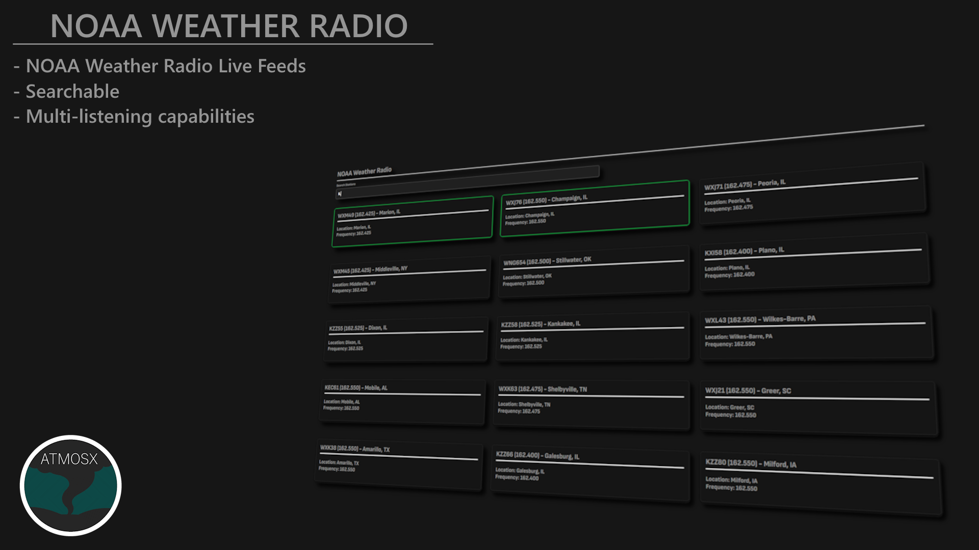
Local Storm Reports (LSR)
Local Storm Reports (LSR) are official reports issued by various sources, including the National Weather Service (NWS), storm chasers, and other weather enthusiasts. These reports provide detailed information about severe weather events, including tornadoes, hail, wind damage, and flooding. AtmosphericX integrates LSR data to provide users with real time updates on severe weather conditions in their area. This feature is particularly useful for storm chasers and emergency responders who need to stay informed about local weather events as they happen. Users can access LSR data through the dashboard and mapbox, allowing for easy visualization and tracking of severe weather events. Various sources include:
- Iowa State Environmental Mesonet (IEM)
- mPing
- Spotter Network
- NOAA Weather Wire Service (NWWS)
- GRLevelX
Note: You can only run one source at a time. There is not support for multiple sources at this time.
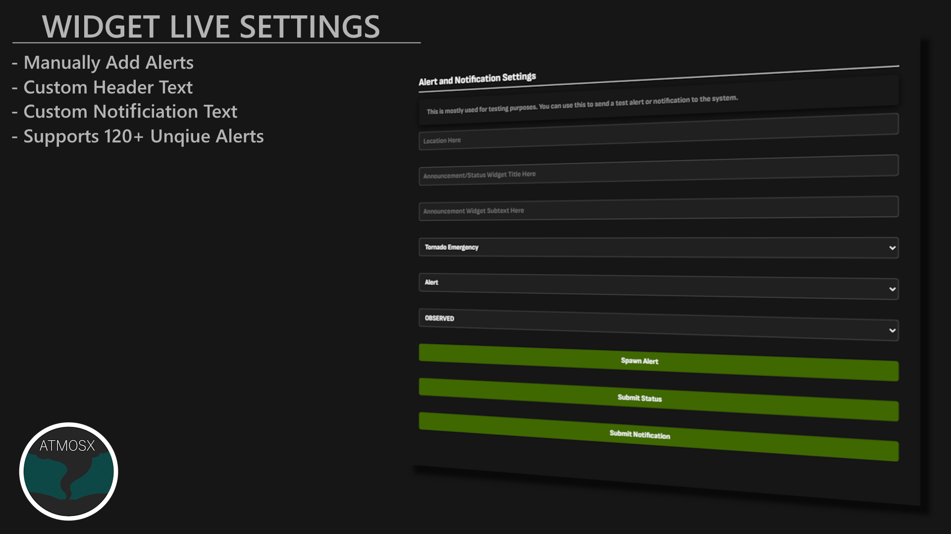
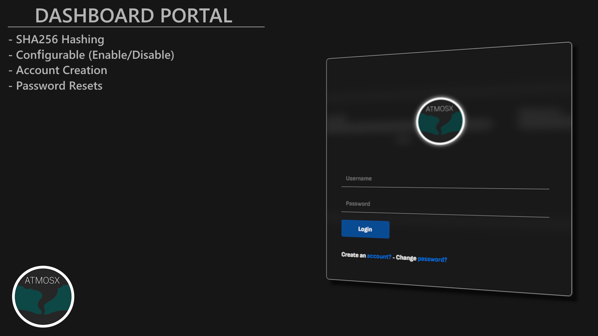
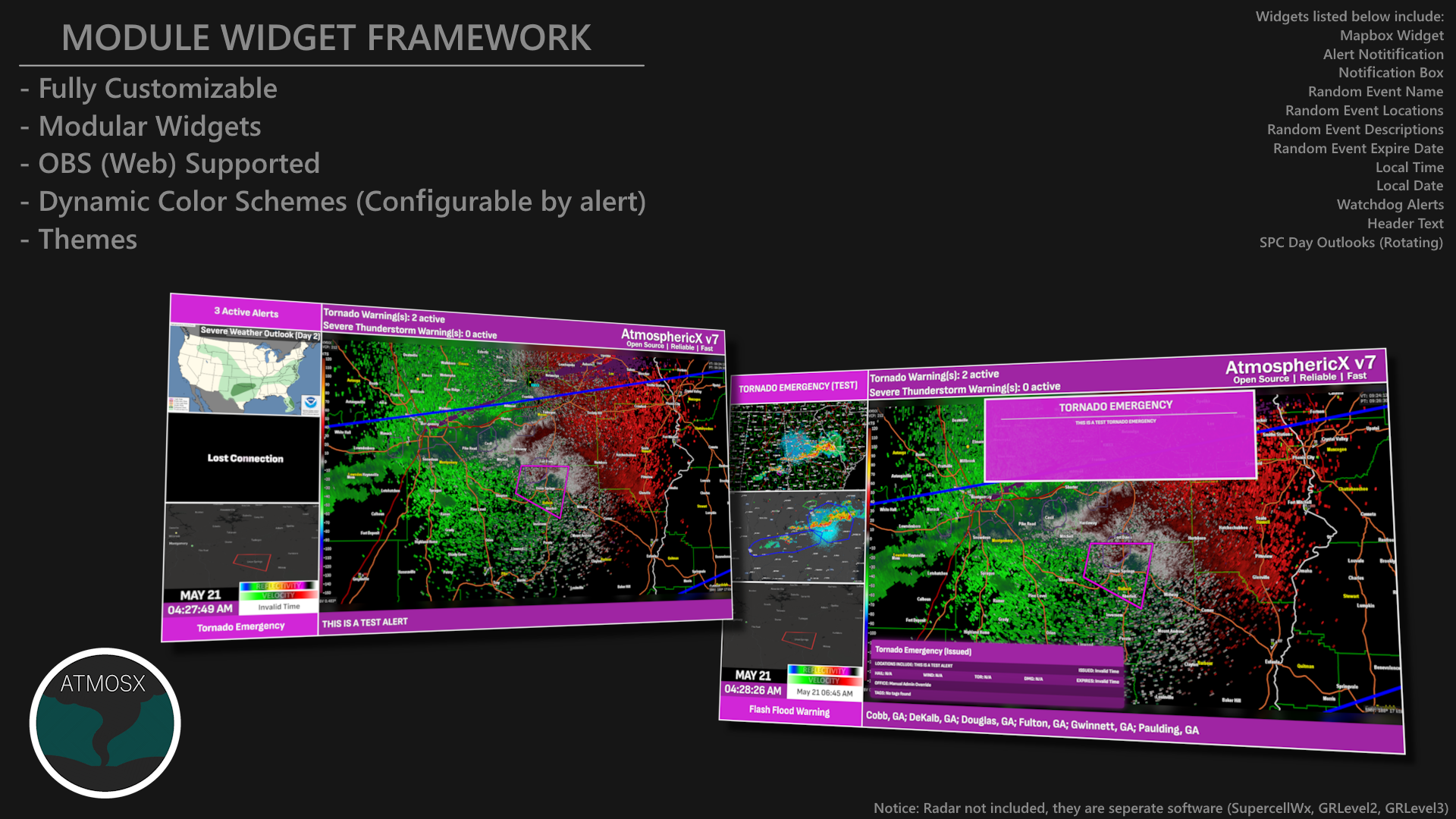
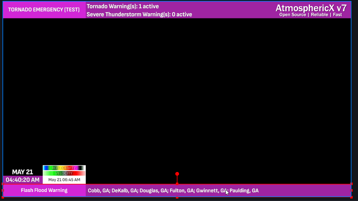
Dashboard & Widget Framework
AtmosphericX features a fully redesigned dashboard and a powerful widget framework for streamers, developers, and general users. The dashboard prioritizes simplicity and ease of use, avoiding unnecessary animations or transitions to ensure a smooth experience. While the dashboard itself is not highly customizable, the widget framework offers flexibility, allowing users to fine tune elements to match their specific needs. By default, the interface is intuitive and user friendly, making it easy to navigate and understand without extra setup. Below are some exampels of the dashboard and the modular widgets in action. It is important to note that your creativity is the only limit when it comes to customizing these widgets. Feel free to upload and experiment with your own designs and ideas by modifying the CSS/HTML files provided by the project.